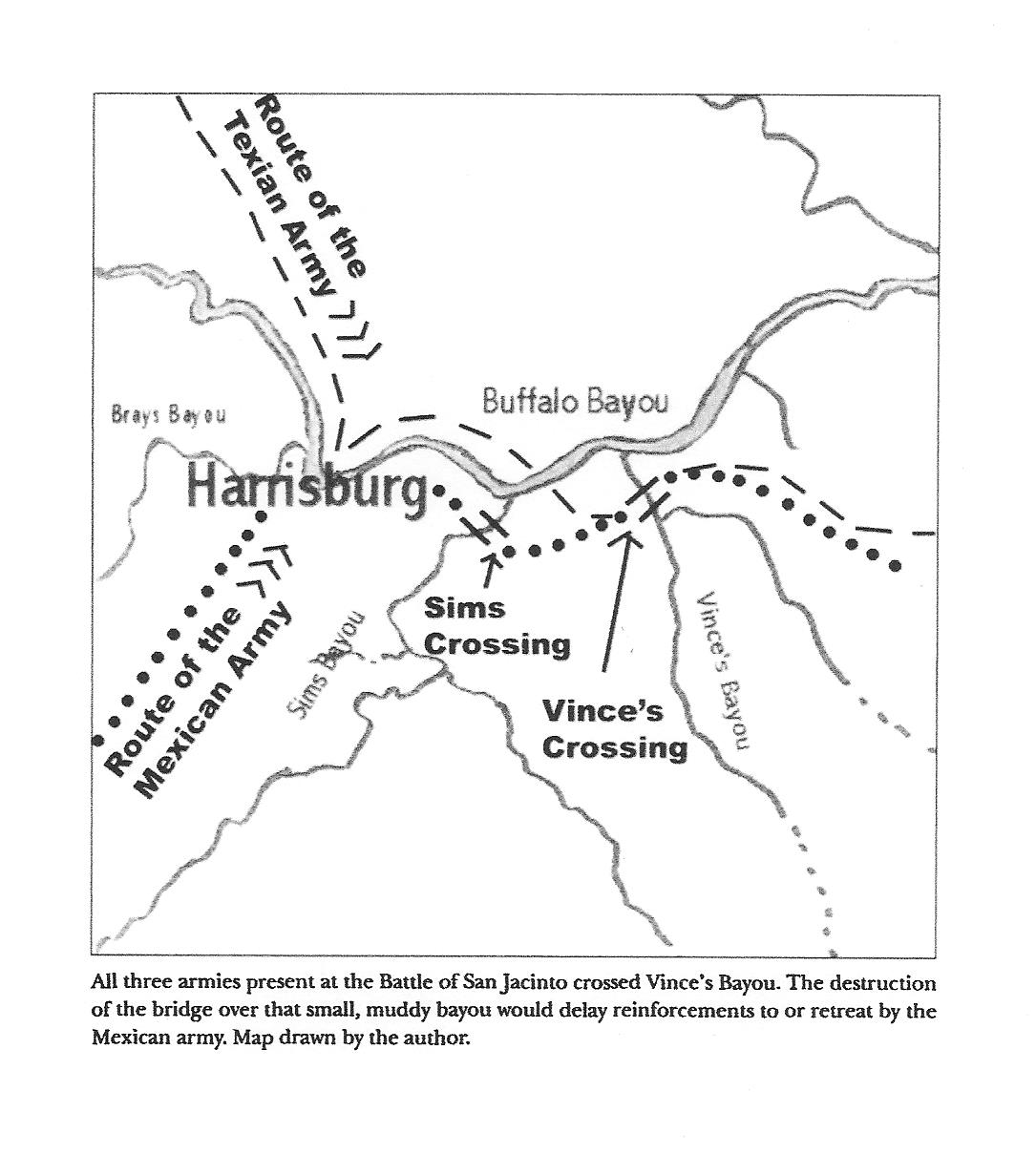
The Daughters of the Republic of Texas placed a series of historical markers on the San Jacinto Battleground in 1913 locating the various elements of the 18 minute battle that changed the course and shape of American history. Texas won its independence from Mexico on April 21, 1836 and the Republic of Texas joined the United States as a member state on December 29, 1845. Ultimately approximately one million square miles of land was added to the United States, completing its westward expansion to the Pacific Ocean. The Daughters placed one marker off of the battlefield because of its significance to the victory, the location of William Vince's bridge over Vince's Bayou. Texian General Sam Houston ordered the bridge destroyed before the battle and that prevented the Mexican Commander & Chief, General Santa Anna, from escaping the battlefield. Santa Anna was captured near the destroyed bridge and Texas independence was achieved. Over time the location of the bridge has been challenged, suggesting it was located over Sims' Bayou, not Vince's Bayou. In 2009 historian C. David Pomeroy, Jr. authored the following article in the peer reviewed Southwestern Historical Quarterly, confirming the bridge was over Vince's Bayou as originally identified. The article follows courtesy of the Quarterly. The appropriate citation for the article is: C. David Pomeroy, Jr., "Reassessing the Location of Vince's Bridge: Critical Prelude to the Battle of San Jacinto," Southwestern Historical Quarterly, Volume 112, Number 4, April 2009, pp. 410-427.
Return to Texas 1836 home page
12.23.2016